Image

Blog
Spatial analyses that incorporate GIS and remote sensing are in demand in academia, industry, nonprofit, and government jobs related to ecology, geography, marine science, environmental justice, energy development, climate science, and beyond. And as technology rapidly develops, new tools become available and grow in prominence. One such new tool is Google Earth Engine, a powerful, free-to-use (for academia) cloud-computing tool that centralizes and streamlines much of the workflow in remote sensing analyses.
Google Earth Engine provides powerful tools for scientists to conduct analyses of global-sized datasets from a web browser anywhere in the world. Such computationally intensive analyses were previously restricted to only those researchers with access to, and programming skills for, high-performance computing clusters (i.e., supercomputers). Google Earth Engine’s cloud-based computing platform democratizes spatial analyses in a revolutionary way. It also allows for the creation of user-interface apps to disseminate the results of analyses to project partners and environmental stakeholders—to anyone with access to the internet.

However, there are currently no courses that comprehensively teach Google Earth Engine offered at Duke University. Knowing the value of this tool for future career prospects involving large-scale spatial analyses, we made a proposal for a Professional Development Grant to fund trainee participation in a course on Google Earth Engine. We used the funds to participate in a synchronous, remote class offered by former Google engineer Ujaval Ghandi through his teaching platform Spatial Thoughts.
The course consisted of 24 hours of material spaced over three weeks, which felt like just the right pacing, progressing from a manageable stream of basics to a full-on firehose of complex possibilities that can be taken in a dozen directions. Ujaval taught with practiced efficiency, and his expertise in the subject was matched only by his commitment to making these powerful tools accessible and understandable to everyone. We were extremely grateful to have taken this course and for access to all the code Ujaval makes available. This code and much of the teaching material is freely available through the Spatial Thoughts website; however, participating in real-time teaching helped us learn much better than trying to read and understand code on our own.
Below is a list of participants in the course/professional development grant and what they intend to use Google Earth Engine for in their own research. Those participants with email addresses listed have volunteered to respond to any queries about using Google Earth Engine in similar research. Feel free to contact us if you are interested in doing similar spatial analyses!

Ankita Gupta | ankita.gupta@duke.edu
I am a Ph.D. candidate in environment. In my research, I use Google Earth Engine (GEE) to access and analyze large-scale remote sensing data for monitoring hydrological changes and their impact on waterbird populations in wetlands. GEE allows me to efficiently process satellite imagery to assess land cover changes, water levels, and vegetation dynamics over time, providing valuable insights into habitat quality and bird distributions. This platform is essential for integrating spatial and temporal data at a landscape scale, supporting ecological modeling and conservation planning efforts.

Arona Bender | arona.bender@duke.edu
I am a Ph.D. student studying the movement ecology of sea turtles as they leave their nesting area and migrate towards their foraging grounds. I use remote sensing to track and analyze sea turtle movements, monitor environmental conditions, and map critical habitats. I plan to use Google Earth Engine (GEE) to access and integrate satellite imagery and environmental data, such as sea surface temperature and ocean currents, to better understand the factors influencing sea turtle migration.

Brandon Hays | brandon.hays@duke.edu
I am researching how Asian elephants shape forests and how forests shape human-elephant conflict in Southeast Asia. Remote sensing allows us to look back in time to see how forests have changed, but tropical remote sensing is often hindered by high cloud cover and humidity. I plan to use Google Earth Engine’s incredible ability to mosaic many images on a per-pixel basis to construct time series of changing forest structure in Eastern Thailand. By relating this to changes in elephant populations I will be able to infer impacts of elephants on forests.

Camille DeSisto | camille.desisto@duke.edu
I am a Ph.D. student in ecology, and most of my research focuses on environmental change and its consequences for species interactions and ecosystem functioning. One major environmental change I am interested in is forest loss. I anticipate using GEE in future projects to conduct land use classifications for my study area and analyze patterns of forest loss. I will also likely use GEE to extract other relevant variables for my study sites, such as climatic data and maybe even socio-demographic data. In the future, I hope to conduct some analyses at broader spatial scales, so using GEE will be important for ensuring that these analyses are feasible and efficient.

Keqi He | keqi.he@duke.edu
I am a Ph.D. candidate in earth and climate sciences and my research focuses on climate-driven wetland degradation in the southeastern United States. In my current study, I used remote sensing images to analyze how wetland degradation patterns have evolved with climate change. However, performing this analysis on my local computer was time-consuming due to the extensive data downloading required. In the future, I plan to use Google Earth Engine (GEE) to streamline these processes, making them much easier and more efficient.
Halina Malinowski | halina.malinowski@duke.edu
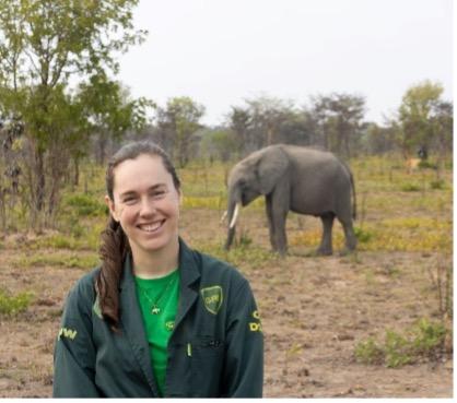
I am a Ph.D. candidate in ecology studying the impact of anthropogenic disturbance on African savanna elephant movements and body condition. I aim to use Google Earth Engine (GEE) in my research to use satellite imagery to assess habitat classification and examine landscape and vegetation changes related to burns and droughts in our system. I would also like to examine human presence, population, and land use change over time using several of the GEE databases such as the Global Night Time Lights dataset. I will then overlay elephant movement data and determine how environmental factors and human presence impact elephant movements and habitat selection.

Skye-Anne Tschoepe | skye-anne.tschoepe@duke.edu
I am a Ph.D. student in environment. My research focuses on the environmental justice implications of natural gas infrastructure development, including air quality and flammability concerns related to methane leaks from gas transmission pipelines and other transmission infrastructure. In the future, I will use GEE to identify large emitters of methane and compare methane fluxes from these emitters to field-based measurements. This will broaden the geographical and methodological scope of my work. Additionally, I will use flood data to understand how natural gas development impacts watershed-level hydrology.

Sarah Roberts | sarah.roberts@duke.edu
As a postdoc on a project focused on climate change, forest fires and human health in Zambia, I am using GEE to analyze forest cover change as it relates to environmental changes and burning. I will use GEE to extract forest cover throughout my study region as well as precipitation and temperature data. Additionally, GEE has a suite of fire-related datasets that I will use to capture burn frequency, severity, and timing (early vs. late season) over time in my study site to understand if the intensity and magnitude of burns is increasing with climate change, and, in turn, influencing human health.

Ph.D. student, Ecology
Brandon is pursuing a vocation in ecological conservation. Although he studies terrestrial forests and fauna, he is quixotically housed in the Marine Robotics and Remote Sensing lab. When not conducting remote sensing analyses, Brandon enjoys building community amongst grad students, touching animals, and chopping wood. You can find him on highly limited social medias if you try hard enough, but it would be easier to view his Duke Scholars profile.